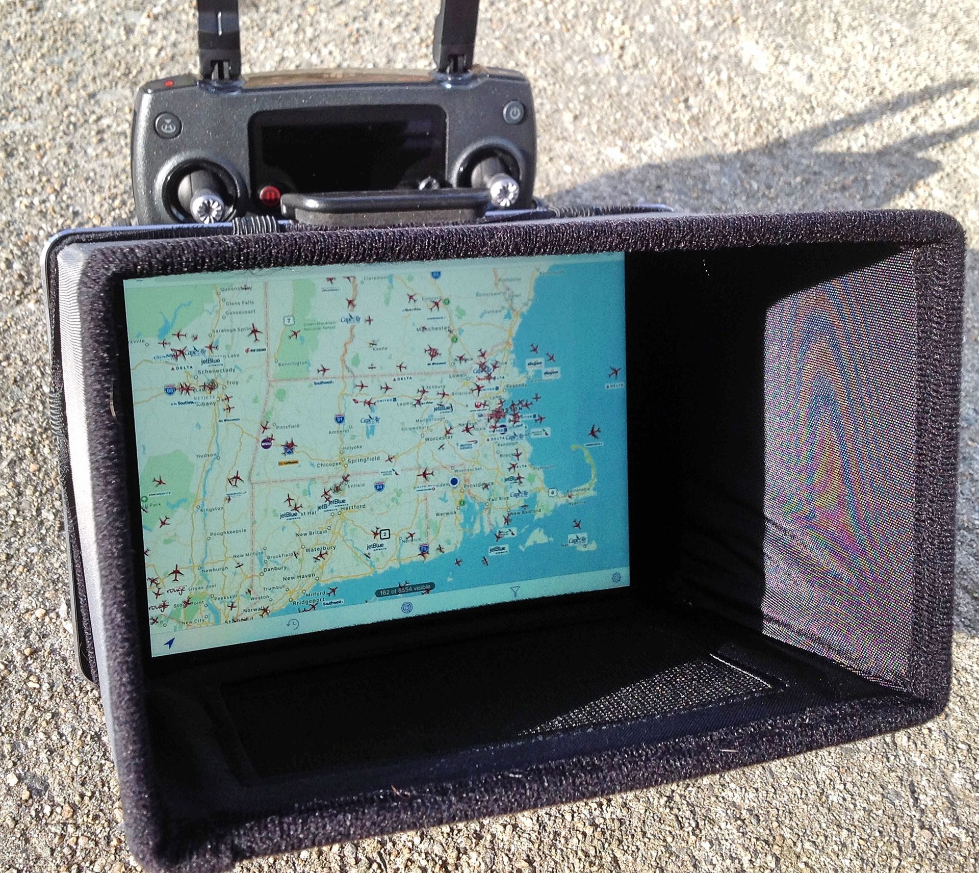

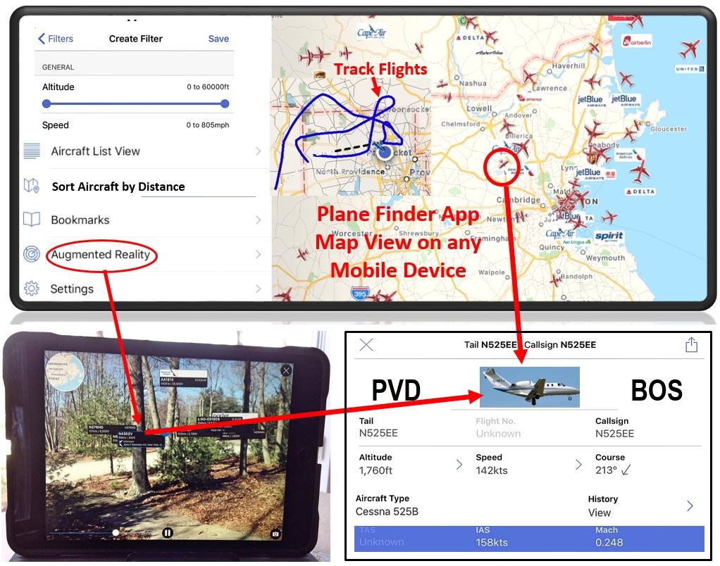
The Plane Finder app allows a pilot to identify in real time all manned aircraft equipped with ADS-B within a range of 1 to 100 miles from their mobile device. Roughly 70% of aircraft flown today have ADS-B systems and all aircraft are required to have ADS-B by 2020. Aircraft can be selected for viewing by two methods. When the app is first opened, all of the aircraft in the 100-mile range will be displayed on a map centered around the user’s mobile device. The aircraft will be moving at their relative speeds over the map terrain. Tap on any aircraft and an information tab will provide flight numbers, routes, altitudes, speed, course, call sign, and flight history. The aircraft displayed can be altered via a menu to filter or sort aircraft by type, name, flight number, altitude, distance, speed, and more.
The second method is activated by selecting Augmented Reality in the menu. This will activate the mobile device’s camera view screen with a slider on the right to adjust the range of aircraft to be displayed from 1 mile to 100 miles. The user can point the camera at airplanes or in any direction and small tabs will display N numbers or airline names with speed and altitude data of manned aircraft in that area. Tapping any small aircraft tab will display the full tab of aircraft data as seen in the map operation mode. Andy A As part of the pre-flight check on my DJI Mavic, I use the Plane Finder App to see if any manned aircraft are in the area before takeoff. ______________________________________________________________________________________________________________________________________ |